Welcome to the continuation of building an overland route to Moab from Durango. Part 1 of this series took us about 85 miles, right near the “Dry Creek Hut” on the San Juan Huts System. It allows us time to enjoy some short hikes and maybe even get some fishing in.
Day two is going to involve a lot of adventuring as we will be taking a number of old mining road enroute to our next camp site. There are a few trails that are highlighted in onX Offroad, and our route will try and do as many of these as possible.
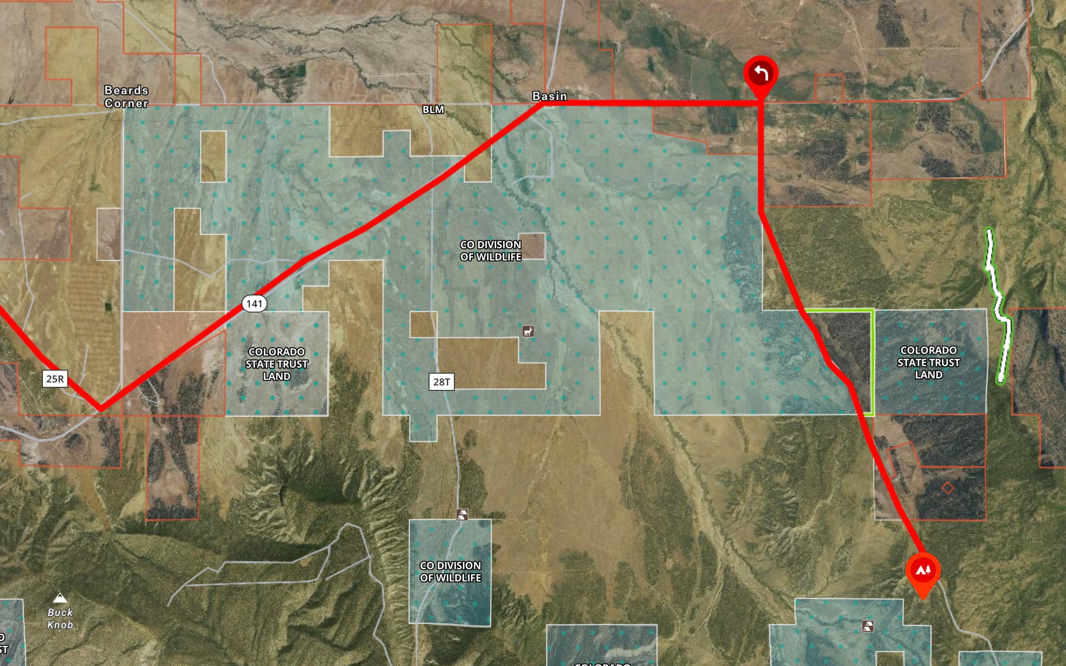
This day will be a little longer (around 110 miles), and will involve a few more 4×4 trails, ending with us hopping on the “Rim Rocker” trail (which is one of the longer routes in onX Offroad at 160 miles) mid way through near the town of Nucla, CO. If you need groceries or gas, both are available in and around Nucla.
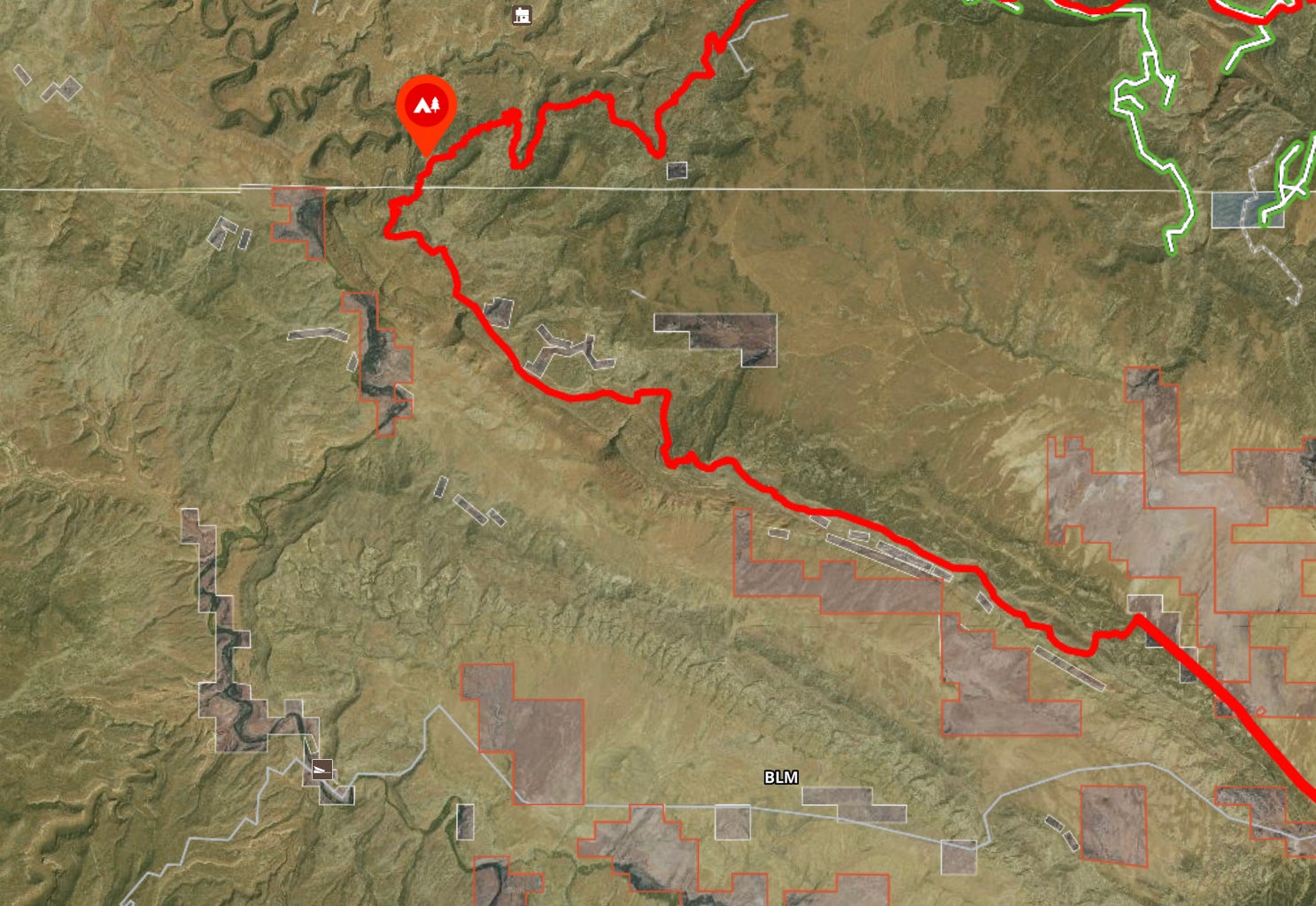
There will be some hard ball on the trail, and we will cross both the San Miguel and Dolores rivers via bridges (sorry, no gnarly river crossings..  ).
).
This segment also has plenty of great views, side hikes to mines, and even places to stop for the night, if you want to extend your journey.
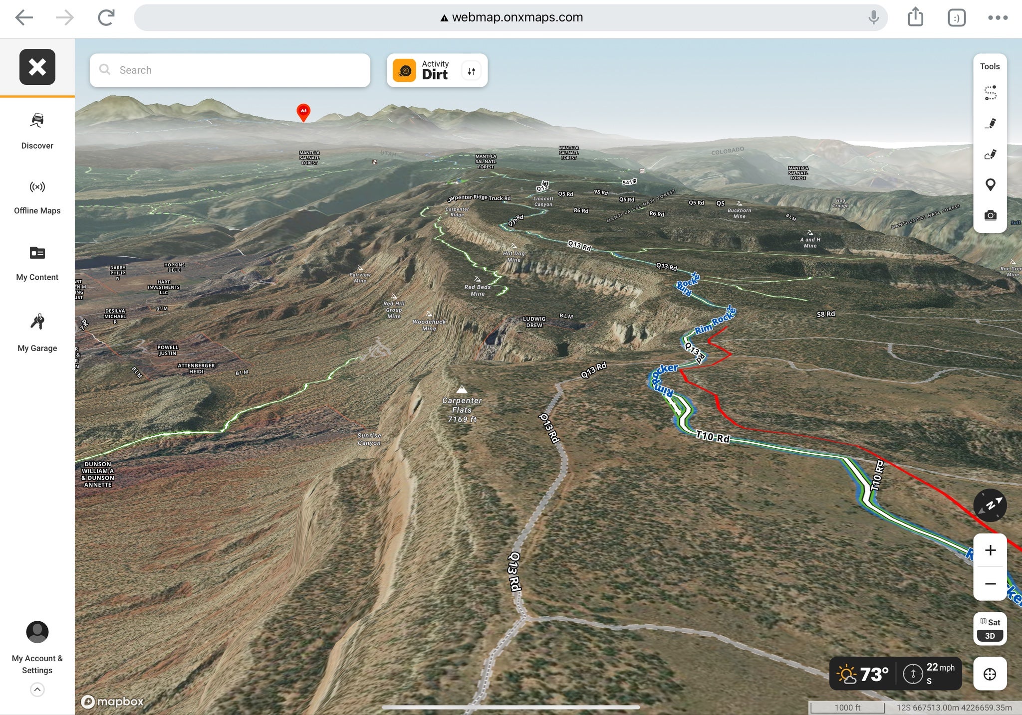
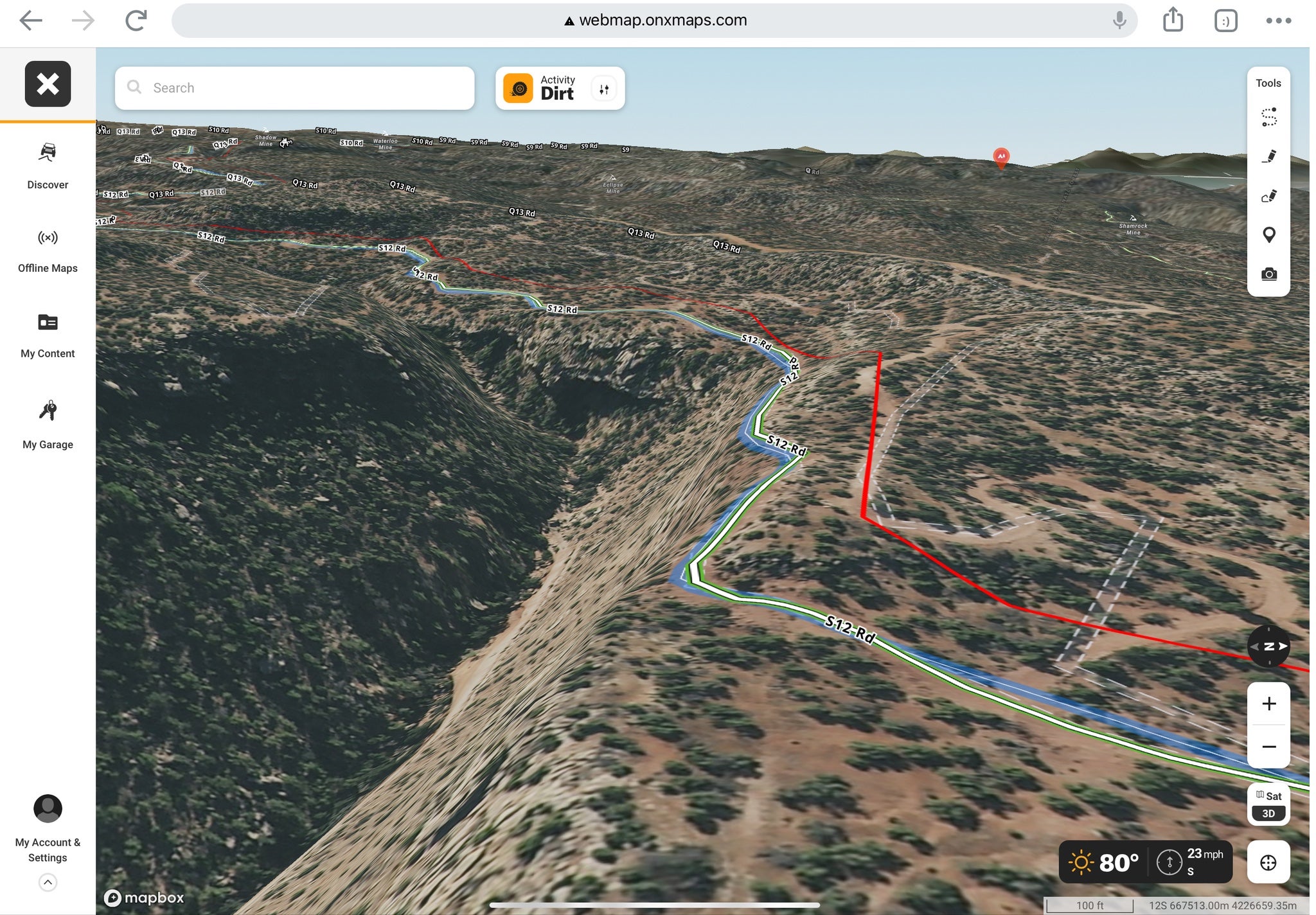
Using the onX Offroad 3D feature, you can easily see the terrain on the map and find generally flat places to put in camp for the night.
Rim Rocker
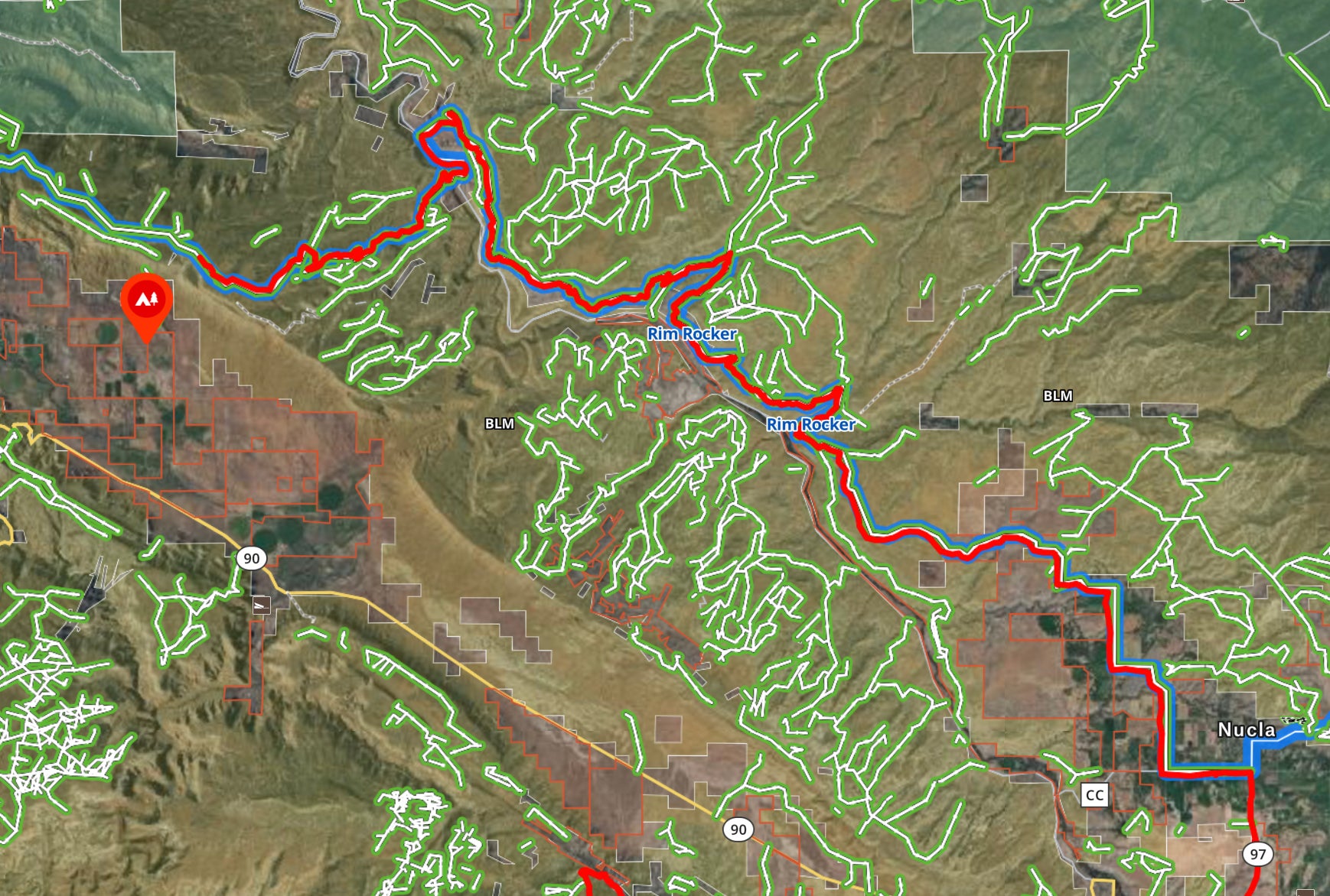
The Rim Rocker trail is a nice trail for inclusion and helps us get the rest of the way into Moab. It was submitted by an onX Trail Guide (Andy Hanks) making the last half of this journey one that has been traveled, and proven doable, additionally with a tear drop trailer.
The Rim Rocker trail is a difficulty 4 (of 10) trail “Visitors are immersed in natural beauty as the trail guides them through a landscape of redrock canyons, winding rivers, desert vistas and alpine forests.”
Why Aren’t There Long Routes in onX?
One of the challenges with defining longer routes in an app like onX Offroad is that people like to explore and manage their own routes. If there are longer routes, it lowers the “barrier for entry”, if you will, and can create heavier impact on the trail and area.
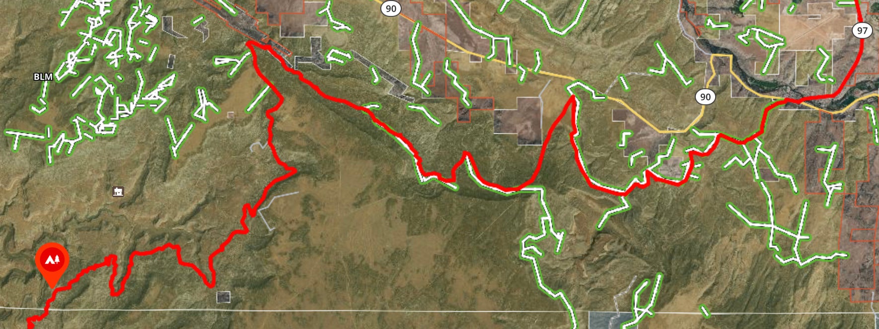
Shorter routes allow people to string them together as they please. Shorter routes also allow for better details and info about the route, especially difficulty.
Also, as you approach a destination, there may only be a select few routes. This funnels all of the routes down and creates a lot of overlap. Not that it is a huge problem, but the concept of crowd sourced route building lends itself to defining shorter routes.
Rolling In To Moab
Since we will be completing this trip on a defined trail, there is no need to do a “Part 3”. The final segment of this route is only about 50 miles (ending in Moab), making the whole trip just under 250 miles. That should be easy range for most overlanders, and within a normal tank range (though of course you should carry extra).
Once I do this trip later this year, and confirm that it is viable and fun, that gives us a route from Durango to Moab. It also gives a route from Durango to Montrose, CO since you could turn right instead of left when you jump on the Rim Rocker trail.
Off-Road and Overlanding is sponsored by
To subscribe, visit: https://subscribe.onxmaps.com/offroad/purchase/membership
The post onX OffRoad: Durango to Moab, Part 2 appeared first on AllOutdoor.com.


